

What Was on the Grounds of the Pillsbury Mansion? Reading the Original Site Plan
Open the Hewitt & Brown drawings for the Charles S. Pillsbury house and the first sheet is not the house at all. Sheet No. 1 is the ground it would stand on: a blueprint of the lot at the north-east corner of 1st Avenue South and 22nd Street, drawn before a single stone was set. It is the least glamorous page in the set and, read carefully, one of the most revealing.
It tells you what was already there — and what the architects intended to take away.
What the drawing is
The title block reads, in the firm’s distinctive lettering, Residence for Mr C. S. Pillsbvry — North East Cor. 1st Ave S. & 22nd St., Minneapolis, Minn. The stamp in the corner is Hewitt & Brown, Architects–Engineers. As on every other sheet in this set, the printed fields for Drawn by, Checked, Date and Revision were left blank — which is why this house has four different start-and-finish dates in circulation and we decline to pick one.
In the right-hand margin sits a small Block Plan at an eighth of an inch to the foot, with a north arrow. The main drawing is a survey and grading plan: property lines, spot elevations, contour lines, drainage, walks, drives, walls — and trees.
The neighbours, named on the drawing
Two labels on Sheet No. 1 are simply the names of the people next door.
Across the north property line, above the retaining wall, the draughtsman has written MISS CROSBY. On the block plan to the east, the outline of another house is labelled A. F. PILLSBURY — Alfred F. Pillsbury, Charles’s brother, whose collection of Chinese jades would eventually go to the Minneapolis Institute of Art. The brothers were building on the same block.
We should be plain about the limits of this: the plan gives a surname and a courtesy title and nothing else. Minneapolis in this period had Crosbys of considerable prominence in the flour trade, and it would be an easy and satisfying leap to connect the neighbour on 22nd Street to them. We have not established that, so we are not going to write it. What the drawing establishes is narrower and still interesting — that these plots were close enough, and their occupants known enough to each other, that the architect labelled them by name rather than by lot number.
A page mostly about trees
The single most striking thing about Sheet No. 1 is how much of it is devoted to individual trees. Each one is drawn as a small circle, then annotated with its species and the diameter of its trunk: Bur Oak 12″, White Oak 14″, Black Oak 14″, Black Oak 18″, Black Oak 20″, a Double Bur Oak with two trunks measured separately at ten and six inches, and — at the south-west of the lot — a Black Oak recorded at forty-five inches in diameter. That is a tree that was already old when Minneapolis was a milling town of shanties and sawmills.
Beside a good number of these annotations is a single word: Remove.
It is a cold thing to read. It is also, in fairness, what building a large house on a wooded corner requires, and the plan is at least honest enough to record what was standing before the work began. Two Lombardy poplars are marked along the east wall — planted, not inherited, and a fashionable choice for screening a property line in 1910s landscape practice.
Nine feet of fall
Thin numbered lines wander across the sheet: contours running from 94 at the north-east down to 103 at the south-west. Read together they describe a lot with roughly nine feet of fall across it — not dramatic, but quite enough to matter when you are setting an eighty-seven-foot house on it and want the front door to meet the sidewalk properly.
Hewitt & Brown’s answer is written all over the drawing. A retaining wall runs a little over 137 feet along the north edge. Balustrades are called out along the street frontage. Spot elevations are pinned to the top of every wall and step. Walks are labelled granolithic — the period term for cast concrete paving, which was then a modern material and a mark of a good address. The drive is drawn as block paving, and where it meets the street the plan specifies a sunken curb.
Drainage is everywhere: weep holes through the retaining walls, downspouts and roof drains marked at the building line, catch basins, and a six-inch soil pipe running to the sewer. A house that size on a slope is mostly a water-management problem, and the architects treated it as one.
The cistern, again
At the south-west corner of the house, the plan draws a circle and labels it Cistern, with a catch basin and a water pump beside it. Readers of our piece on what was in the basement will recognise it: the same feature appears on the basement sheet, in the same corner. Rainwater off the roof was collected, stored and pumped back into use — a thoroughly Edwardian piece of thrift built into a house that was otherwise spending money like water.
It is also the reason the word turns up on our sister property: at 300 Clifton, the speakeasy under the mansion is called Gertrude’s Cistern, and it is named for exactly this kind of tank.
One word that has changed meaning
Along both street frontages, outside the sidewalk, the drawing is labelled Parking.
It does not mean what you think. In American city planning of this era, the “parking” was the planted strip between the sidewalk and the kerb — the boulevard, in Minneapolis usage — so called because it was the sliver of park the city ran down every street. There are no cars implied anywhere on this sheet. It is a small reminder that a hundred-year-old drawing is written in a hundred-year-old language, and that reading one properly means resisting the urge to translate.
What is still there
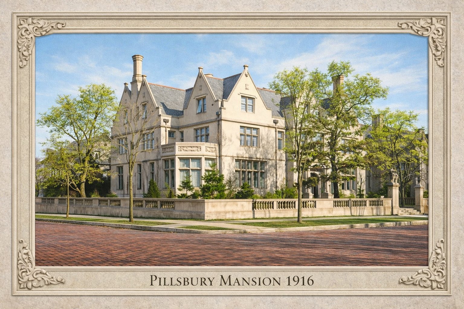
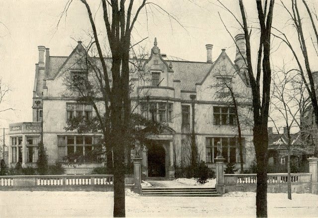
Walk to 100 East 22nd Street today and a surprising amount of Sheet No. 1 is legible on the ground. The balustraded wall along the street is there. The relationship of the house to the corner — set back, raised, approached up steps — is exactly as drawn. The block still slopes the way the contours said it did.
The house is on the National Register of Historic Places and is a designated Minneapolis landmark; the City’s landmark record and the National Register both carry it. The fortune that paid for it is told at Mill City Museum, and the case for keeping buildings like it standing is made every day by the National Trust for Historic Preservation.
The oaks are the part you cannot check. There is no way, from this sheet alone, to know which of them were actually taken down and which got a reprieve. What we have is the moment before — a page on which somebody wrote the size of every tree on a corner lot, and then decided.
See it in person
More of the story is on our own pages: Building the Mansion, The Owners, and The Pillsbury Family. If you would rather see it than read it, we run guided mansion tours year-round — plan your visit, and stand on the corner the drawing describes.
Keep reading: What does a cross-section drawing reveal about the Pillsbury Mansion?